
The trek to Ciudad Perdida, the Lost City of the Tayronas, has reached a fairly legendary status on the travelling circuit, and for good reason. It's a difficult multiple-day trek through tough terrain in northern Colombia's Sierra Nevada mountain range, and after days of slogging through the jungle, you end up at the stunning medieval ruins of the Lost City, where the lush tropical rainforest reveals one of the most beautiful and atmospheric archaeological sites that I've ever seen. This trek is being called the new Inca Trail and the Lost City the new Machu Picchu, and for once this isn't overblown marketing.

On top of the physical challenge of getting there, the Lost City has a bit of a dubious history. Founded around 800 AD, some 650 years before Machu Picchu, the bulk of the city was built between the 11th and 14th centuries and was home to at least 2000 people; however, it was abandoned soon after the Spanish arrived, and the site remained hidden by the jungle until it was rediscovered in 1972, when a group of local treasure hunters – or guaqueros (grave robbers) as they were known – happened upon a set of stone steps leading up from the banks of the Río Buritaca. Word of the discovery spread among other groups of guaqueros, and soon enough fighting broke out between rival gangs, all of them trying to get hold of the gold and stone artefacts that were buried inside the site's circular structures. In 1976 the government sent in troops to stop the fighting and the Instituto Colombiano de Antropologia sent in an archaeological expedition, and they spent the next six years clearing the rainforest from the site and reconstructing the ancient city, while continuing to dodge bullets from guaqueros who wouldn't take no for an answer.
But the story doesn't end there. This part of Colombia used to be a hotbed of guerrilla activity, not least because it was a major producer of coca, the raw ingredient that's used to produce cocaine, and back in 2003 a group of eight foreign walkers was kidnapped by the left-wing National Liberation Army while walking to Ciudad Perdida, and they were held captive in the jungle for three months before finally being released. I remember this happening because we knew one of the kidnapped tourists – he'd been the boyfriend of a co-worker during our dot-com days – and this made it all seem rather real. The area is now supposed to be safe, as the government removed all the paramilitaries from the area in 2008, though the UK government's travel advice says to make sure that your tour company knows what it's doing, because although there is a strong military presence in the area and nobody has been kidnapped since, it still pays to be careful.
So you have the perfect storm: a difficult slog through tropical rainforest to the ancient ruins of a lost civilisation, through an area with a tinge of modern-day intrigue and danger. It's no wonder that this trek is so attractive to travellers, and for once you should believe the hype: it's an amazing walk... but only if you do it right. This is the Gringo Trail, after all, and there are plenty of people who don't listen to advice, so while we enjoyed our walk, there were plenty of casualties along the way among those who'd bitten off more than they could chew. You can choose how fast to do the walk, from four, five or six days, and we chose five days; this turned out to be a good choice, as the four-day option is only for masochists or the super-fit. And Peta, for whom this was her first ever multiple-day hike, did a better job of tackling the jungle than people half her age; you don't only need to be physically fit, you need to be mentally strong, because this is no walk in the park.
Five Go Walking

The only way you can do the walk to Ciudad Perdida is as part of a guided group – independent walking is not allowed for security reasons – and we lucked out with our walking companions. As with all group tours, there's an element of risk that you'll end up in a group of idiots, but we were not only lucky with the people in our group, but with the size. Some of the groups we encountered on the trek had 14 people in them, but we were just four: the two of us plus a Canadian couple. Oliver and Emily were both 23, both from Montreal, and being Canadians they were both genuinely good people (or, as you might say if you're from round those parts, they were super-nice). They wanted to take their time on the walk, as we did, and they wanted to enjoy the walking experience rather than treat it as a backpacker party; as we did the walk, the four of us would look on in horror as some of the other groups noisily high-fived each other while necking beer and comparing tattoos. We were lucky, no doubt about it.

We were also lucky in our guide, Antonio. When we turned up at the Expotur office, we were initially introduced to a guide called Wilson, who spoke English and who seemed pretty good, but as we sat in the back of the van taking us from Santa Marta to the trailhead at the village of Machete, Wilson announced that he had to go to hospital, so instead Antonio would be taking us. We were initially a bit annoyed to discover that Antonio couldn't speak English, but he would turn out to be a real find, not least because he's a stunningly good cook; he told us he spends nine months of each year guiding groups in Ciudad Perdida, but during the three quietest months, when the rain lashes down, he works as the cook in a ranch. Eating well is such an important part of walking, and Antonio's food was head and shoulders above that of the other groups, who looked on in envy. And even more amazingly, both Peta and I, with our limited Spanish, understood almost every word that Antonio said; he obviously spoke slowly and clearly for our benefit, and the language barrier simply evaporated.
Day 1: Machete to Alojamiento de Alfredo (8.4km)

It's about an hour and a half by van from Santa Marta to the trailhead in the small village of Machete, so our trek started off with lunch in Machete at the end of a bumpy and grinding drive south from the coast at Tayrona. Although we were keen to get walking, it made sense to hide from the midday sun and to set off later in the afternoon, though as we tucked into piles of ham, cheese and salad sandwiches, the clouds rolled in and hid most of the sunlight anyway. A larger group turned up as we munched away, though as they were doing the faster four-day option we wouldn't see them again until they passed us on their way back; still, we could see straight away that having a small group was a big advantage, as everything in the larger group seemed to take ages, from serving lunch to getting ready to walk.
After lunch we set off on the trail, passing a happy group who were just completing their walk. 'It's amazing,' they said, 'you're in for a real treat,' and with that we stomped off down the dusty road out of Machete and north towards the hills.

It was incredibly dry and dusty from the very first step. When researching this walk, I'd read all about terribly muddy conditions and difficult river crossings, but every step we took kicked up fine, light dust, and when we reached our first river, it was terribly sedate and easy to cross on the smooth, round stepping stones that someone had kindly laid out for us. This theme of dry conditions and gentle rivers would stick with us to the end; completely by chance, it turns out that this is one of the best times to do the trek to Ciudad Perdida, as the rain hasn't started yet (it generally arrives in April, but we haven't seen any yet). In the rainy season the fine dust turns into epic amounts of mud and the rivers run dangerously high, but in April, the balance is just right for easy walking and good swimming, even if it is a little dusty.

We confirmed this after half an hour, when we arrived at our first swimming hole, threw off our packs and jumped into the crystal-clear waters. Small fish came and nibbled at our extremities and we washed the dust out of our hair, glad of the break from the humidity that had already soaked my T-shirt from back to front. We didn't know it at the time, but this was the calm before the storm, because that first half hour's walking was completely trivial compared to what came next: our first ascent. At the end of the walk, on day five, we would take a dip in the very same swimming hole after a long and brutal seven-hour slog in astonishing 45° heat, and I remember looking at the groups just starting out, being lulled into a false sense of security by the sedate wander along the riverbank to this first refreshing swimming break. 'Enjoy it while it lasts,' I remember thinking, 'because this is where it starts to hurt.'

I digress, though, because back at the swimming hole, we still had absolutely no idea what was coming next. The swim was refreshing, but all that went out of the window as we headed upstream, crossed to the opposite bank and started the first major climb of the trek. At this point in the walk the path disappears into a series of steep switchbacks that are carved deep into the chalky rock, and at each turn the path is coated in a thick layer of fine dust that settles on your pack, sticks to your sweaty T-shirt and turns your boots whiter than a pair of miller's wellies. Luckily as we tackled the ascent the sun was still hiding behind a thick layer of clouds, so it wasn't as hot as it could have been, but we still had to stop at almost every corner to catch our breath. Luckily the views were getting better and better as we climbed, which was an incentive to keep on plodding.

This was where we set the walking pattern for our entire trek. Peta and I would set off at a regular and comfortable pace, while Oliver and Emily would either fall back after finding something particularly interesting to explore, or head out in front with the enviable energy of 23-year-olds; meanwhile Antonio would disappear to do his own thing and would pop up at just the right moment later on the path, complete with a stack of watermelon slices or a chocolate fix or a slice of cheese. It suited us perfectly, as it meant we effectively did the entire walk on our own, with the two of us plodding along at our own pace while our guide did just the right amount of guiding. We had two friendly group members to bump into every now and then, to swap war stories and talk about the trek, and then we had the trail to ourselves until the next pit-stop. We loved it; we felt like we were exploring, rather than tagging along in a large tourist group.

This approach also made the difficult parts slightly more bearable. The first steep slope seemed to go on forever – it actually went from 200m above sea level to 600m above sea level – but there wasn't any pressure to go too fast, which we would have had in a bigger group or with a more insistent guide. We hit the slope just before 3pm and reached the end of the steepest section an hour and a half later; this included a very welcome watermelon break after 45 minutes, but apart from that it was a proper workout, which we tackled at our own speed. It was to be the first of many.

The reward for such a steep climb was a wonderful view over the foothills of the Sierra Nevada; at this point in the walk there isn't a lot of tree cover, and you can see for miles. The whole area is farmed by the local campesinos, and it wasn't long ago that this part of the world was used for growing coca, the raw ingredient of cocaine; these days you can see the remains of the coca fields that were destroyed by the government as part of the recent effort to stamp out Colombia's cocaine trade, and these days the farmers are turning to cocoa and coffee as more acceptable cash crops (although coca is still legally grown in smaller quantities, as it remains an important part of the indigenous people's culture).

It was at this point that we saw our first casualties of the walk. Two mules passed us in the opposite direction, led by a couple of locals, and what they carried spoke volumes. The first mule was weighed down by a burly young man whose face was covered in what looked like the bubonic plague, but which were presumably infected insect bites; he looked completely shattered and hid behind a pair of shades as he refused to meet our eyes or respond to our hellos. I couldn't work out whether he was mortified to be doing the walk of shame or was just shattered by his experience in the jungle, but clearly he'd suffered some terrible fate up there in the Lost City, because he looked completely broken. And then, a couple of minutes behind him, the other mule carried an equally burly young man, this time sporting a thousand-yard stare so intense that he looked like he'd just come back from a tour of duty in 'Nam. He also totally failed to acknowledge us and looked like he just wanted to get down off this damn mountain; we couldn't help wondering what was out there that could make two young men look so totally frazzled.

Undeterred, we wandered along the top of a thin ridge that led from the 600m-high summit, passing a small camp called Alojamiento de Adán where a whole row of hammocks sat overlooking the hills. There are various camps along the route – alojamientos means 'lodge' in Spanish – and different groups are allocated to different ones depending on their itineraries and group sizes. They are all of a surprisingly high standard, with running water and cold showers, as well as electricity in some of the earlier camps; sleeping is either in hammocks, beds or tents, depending on which camp you stay in, and you sleep under a roof but with open sides, so you really know you're sleeping in the great outdoors.

We still had a little way to go to our camp for the night, Alojamiento de Alfredo. That 'little way' was down yet another really steep slope, this time dropping down to 450m through yet more deep gashes in the chalky soil. The striking part about this section is the way the bedrock changes colour, from a chalky white at the top, through a deep outback red halfway down, and all the way to a light brown at the bottom. After the big climb it was a relief to be walking downhill and we made light work of the descent, even though it was fairly steep; on the final day, this section would prove to be one of the hardest parts of the entire walk, but the path seemed fairly innocuous as we dropped down into a small collection of hammock-toting camps at the bottom of the valley, crossed a pleasant stream on another set of stepping stones, and climbed a short distance to our stop for the night.

That night we slept in hammocks, with just four of us in a hammock camp designed to house about 50 people. I'd never actually slept in a hammock before, and I'm still not sure that I have, but it was interesting to try; it feels a bit like trying to sleep in an aeroplane, as you can't turn over onto your front and no matter how hard you shuffle about, there are always some parts of you where the blood supply gets cut off. An added bonus was that the mosquitoes, which hadn't been at all bad on the walk in, realised that while they couldn't get through the mosquito nets draped over each hammock, they could get at me through the hammock itself, which was fairly thin and stretched tight by my body weight. So throughout the night I was kept alert by little pinches of mosquito all along my back, and come the wee hours the temperature dropped and my nether regions froze until I realised that wrapping a blanket around my entire body solved both problems, at the risk of causing mild claustrophobia. To be honest, I was glad when dawn broke and we could get on with the walking.
Day 2: Alojamiento de Alfredo to Alojamiento Tezhúmake (7.3km)

The second day started with a huge breakfast, during which we were visited by a friendly parrot who clearly knew that tourists are a soft touch when it comes to handing out food. It was a leisurely start as we only had about four hours of walking to do and the whole day to do it in, but we were still on the trail by 9.30am, as the sun gets you up early when you're sleeping in a shelter that's little more than a roof over a hammock. This time the ascent started straight away, with a climb through more farmland from the camp at 450m, and as yesterday's clouds had disappeared overnight, the walk was noticeably hotter than the day before. Soon we could see a line of deep green up ahead which promised shelter from the unforgiving sunshine, and sure enough it turned out to be the beginning of the rainforest, taking over from the farms we'd been passing through until this point. From this point until the Lost City we would be surrounded by trees, and we were glad to switch the beating sun for shelter, albeit with higher humidity.

The trail didn't stop climbing, though, and at 10.30am we reached the top at about 730m above sea level. By this stage we were both starting to feel the effects in our legs, and as if reading our minds, Antonio pointed to a pile of sticks on the summit that looked like they might be a suitable solution; a couple of minutes later Peta and I had a stick each, and the next day we'd both pick up a second stick, which saved a lot of stress on our knees, though it did make us look like a couple of lost skiers. The sartorial trade-off was worth it, though; using walking poles reduces stress on the knees by about 40 per cent, which is worth looking a bit stupid for.

One of the things you learn early on about the trek to Ciuded Perdida is that what goes up must come down, so as soon as we crested the forested hill, we started a very long trek down again, right back down to 400m, where we joined the Río Buritaca, the river that flows past the Lost City. The views on the descent were spectacular, and peering through the canopy we could see huge distant mountain tops, deep valleys and the odd farm perched on the steep hillsides. It was a long hike, but the reward at the bottom was the best so far; a short side-trail from Alojamiento de Wiwa took us to an utterly luxurious swimming hole that we had completely to ourselves for an hour and a half. Oliver and Emily entertained themselves by jumping from a high ledge into the clear green water, while Antonio back-flipped from even higher up and we settled on a sun-drenched rock and lazily watched them boil off their excess energy.

It was when we started reassembling for the next bit of the journey that we realised we weren't quite alone, for this part of the world is home to a large number of ravenous ticks. I felt a couple of nips around my knee supports and spotted what looked like tiny spiders trying to burrow into my skin, and Oliver and Antonio soon found their own collection of bloodsuckers trying to bite their legs. The girls, meanwhile, didn't seem to have any problems at all; presumably ticks like the smell of man more than the scent of woman, but as soon as we set off they disappeared. Indeed, this was as bad as the insects got on our trip; we'd read stories of terrible clouds of ravenous mosquitoes along the trail, but it seems that these only appear after the rains hit, so once again it turned out we'd chosen a good time to go.
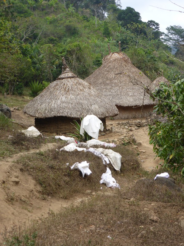
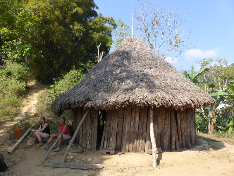
It took us about an hour to walk along the riverbank from the swimming hole to our stop for the night at Alojamiento Tezhúmake. On the way we passed our first indigenous village, Mutanzhi, where the Kogi tribe still live in round mud huts with thatched roofs. The most striking thing about the Kogi are their clothes; because they cultivate cotton, they all wear white garments that stand out really clearly amongst the many greens of the rainforest. The children wear knee-length smocks, the men wear long shirts and long trousers, and the women wear short sarong-like skirts, while the footwear of choice seems to be the good old wellington boot, which is both waterproof for river crossings and sturdy for rocky paths. As we walked further into the jungle we would see a lot more Kogi; they look like indigenous Indians rather than the more common mestizos that you see in South America – a mestizo being a person of mixed Spanish and indigenous heritage – and they wear their black hair long, for both women and men. They tend to be fairly immune to greetings and stare at you as you walk past, but that's hardly surprising, as we must appear pretty strange to them with our backpacks and sunglasses and walking boots, while they still live in huts and travel by mule.

Then again, some of them are very friendly, such as six-year-old Ari who lives with his parents at Alojamiento Tezhúmake, our camp for the night. He joined us in our stretching exercises that afternoon and we taught him to play pat-a-cake, and although he didn't like talking much, we communicated on a different level, using the power of facial expressions, silly noises and broad smiles. He was a charmer, no doubt about it.
And Ari's dad had an ice box full of ice-cold beer, which went down very well after we'd had a quick dip in the river. It also went down very well with the large group who arrived later in the day from the opposite direction; they'd just visited the Lost City, and their loud drinking went on until 10pm, by which time we'd collapsed into bed, this time on bunk beds with mosquito nets overlooking the river, whose white noise gently lulled us to sleep after another long day of fresh air and excellent hiking.
Day 3: Alojamiento Tezhúmake to Alojamiento El Paraíso (6.6km)

Why on earth the proprietor of Alojamiento Tezhúmake decided to start cleaning the camp at 3am is beyond me, but he did and it woke me up along with half the camp, who then decided to visit the ablutions in a long parade of bright head torches that seemed to go on forever. There's no electricity this far into the forest, so everyone comes equipped with head torches, but the problem with head torches is that you naturally look around you while wearing them, so when people decide to visit the ablutions in the middle of the night, it's as if the world is suddenly full of mobile lighthouses. That's fine at 10pm when people are going to sleep, but at 3am it lights up the quiet forest like a nightclub, and it took me quite a while to go back to sleep.
So it was fairly annoying to be woken at 5am by the other group's guide, wanting to know whether or not I was on the four-day trek, who were making an early start; I wasn't and stuck in my earplugs while the other group noisily got themselves up and shouted to each other over their breakfast, and suddenly it was 6am and Antonio got us up for our own breakfast. We'd all suffered a bit from the insanely active wee hours in the camp, and it didn't help that yet again the day started with an immense climb.
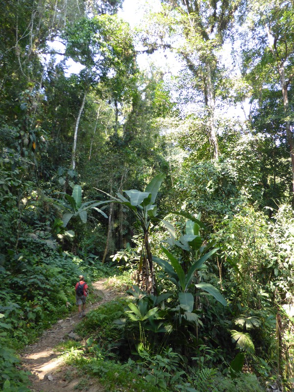
We set off at 8am and followed the river along a thin path that hugged the steep sides of the river canyon – and which tested Peta's vertigo to breaking point – and at 8.30am we crossed the Buritaca on a small suspension bridge and started to climb. It was a long way up from 450m to 820m above sea level, and we passed an indigenous hut that contained a press for crushing sugar cane and extracting the sugar solution, before eventually reaching a small shop at Koskunguena an hour and a quarter later, where Antonio plied us with wonderfully fresh pineapple and bananas. The views on the way were spectacular, when the canopy cleared to let us peek through, but even when we were enclosed by the jungle, there was so much to see, from monstrous bamboo clusters to huge banana plants hanging over the path.

The most spectacular view of all, though, was just down the hill from the shop, where the forest suddenly disappeared and the entire valley opened up in front of us. Over there to the right was a perfectly poised thatched Kogi hut with a stunning vista behind it, while ahead lay the rolling hills of the Sierra Nevada, smothered in forest. It was a bit of a shock to break out into the harsh sunlight after so long hidden away in the depths of the forest, but we needn't have worried, because soon enough we were heading back down the valley for another 100m descent, where the path started following the Buritaca valley once again.
All the while the jungle grew wilder and more picturesque with every turn. We passed gentle streams with beautiful little pools that we wished we could whisk away into our bathrooms at home; we wandered under the blackened and burned-out skeletal remains of a huge tree that an indigenous child had accidentally set alight the year before; we walked through forests of yet more immense banana plants, which seemed to get more and more surreal as we got deeper into the forest; and all the while the views up through the canopy revealed steep-sided valleys crowded with trees, and a lovely blue sky somewhere up there in the distance. It was, not to put too fine a point on it, utterly gorgeous.

After an hour or so of following the river valley, going up and down along the rainforest route high above the river, we eventually descended and had to cross the river. This time we had to ford it without the benefit of stepping stones, which I'd been looking forward to, as the walk to the Lost City has a reputation for difficult river crossings. Disappointingly the first crossing was only shin-deep, and the second crossing about five minutes later didn't quite reach our knees, so in the end it was a bit of a let-down. I'd bought a cheap pair of plastic sandals in Santa Marta for this very part of the trek, and although it made it easier to stomp across the river without worrying about stepping on anything dodgy, I could have done it barefoot; presumably the legends about difficult river crossings are confined to the rainy season.

Half an hour later we reached our stop for the day. Alojamiento El Paraíso is the final camp before the Lost City, and is perched on a pretty bend in the Buritaca River that makes for yet another pleasant spot to cool off after the day's exertions. It was wonderfully peaceful when we arrived, just in time for lunch, and the small group who were resting in the main shelter soon pulled on their packs and left, as they'd just spent the morning at the Lost City, just 1km from the camp, and were now heading back. We lazed around in hammocks and even had time to wash our T-shirts, which were starting to smell pretty badly after being soaking wet for three days straight, but just as we were slipping into a peaceful afternoon snooze, the big group arrived.

It was carnage. There were about 24 of them, made up of two groups who were sharing the same four-day schedule, and they arrived with stories of women dissolving into tears on the trail, and grown men having their own breakdowns en route. Those who had made it to the camp in good time were fine – one American dude was so convinced that he was Rambo that he walked around bare-chested for the whole evening, so he was clearly lapping up the jungle life – but soon enough the rest of the group started arriving in dribs and drabs, and while the first arrivals had been tired but fired up, the stragglers were in all sorts of trouble. The four-day option for this trek combines into one day what we'd split up into days two and three, and this marathon 14km slog had completely destroyed those who had thought they were coming along for a pleasant jaunt, but instead had actually signed up for the hardcore option.
'I cannot understand how anyone would ever enjoy this,' moaned one slightly overweight American girl as she collapsed on the lodge's steps, a stunned look on her face. 'I am completely mentally distressed by this. I just don't know how to cope. I absolutely hate it.'

So it would have been particularly galling for these exhausted walkers to see what Antonio's kitchen magic served up to our small group that night. While the other group tucked into huge plates of rice and chicken – no bad meal when you're on the trail, it has to be said – we waited while Antonio beavered away in the kitchen. The others looked over as we sat there, with us getting hungrier and hungrier as they ploughed through their plates, and when Antonio eventually served up, everyone was wondering what was coming. It was spectacular: a huge, freshly cooked, savoury pancake stuffed with chicken, beef and vegetables, all smothered in a delicious white sauce, and arguably one of the best meals we've had on our entire trip through Central America. Here we were, 1km from the Lost City and eating like gourmands while the exhausted remnants of the four-day group looked on and salivated. Antonio truly was a genius in the kitchen, and that night we slept like pampered royalty, surrounded by the exhausted snoring of those on the quick trip.
Day 4: Alojamiento El Paraíso to Ciudad Perdida (1km), Ciudad Perdida to Alojamiento Tezhúmake (7.6km)
This was the big day, the day of our visit to the Lost City, so we were up at 6am and out on the trail by 7am. It's a rocky half-hour walk from the camp to the entrance to the Lost City, along an even more precarious riverside path than the day before; at times we had to rock-climb our way along the ledge, trying not to look down at the river some 100m below.
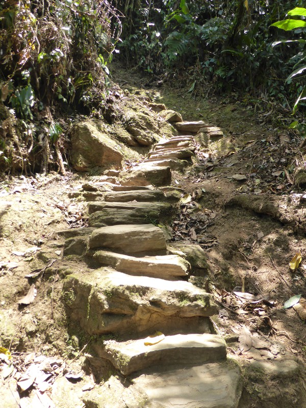
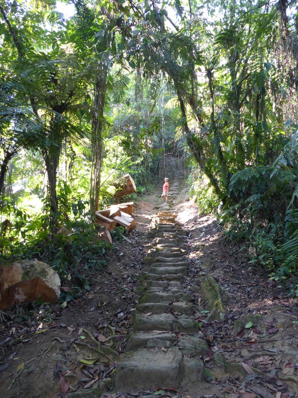
Soon enough we reached the bottom of the stone staircase to the Lost City, which starts on the banks of the Buritaca and takes you from about 950m above sea level up to the city at an altitude of 1160m. This steep climb is up an ancient staircase of 1200 stone steps, some of them large and some of them tiny, though because it was so dry, at least they weren't too slippery (it would be a pretty different story in the wet season). The secret is to take it slow and steady, and half an hour later we reached the entrance to the city itself, and the first of the hundreds of round stone structures that make up Ciudad Perdida.

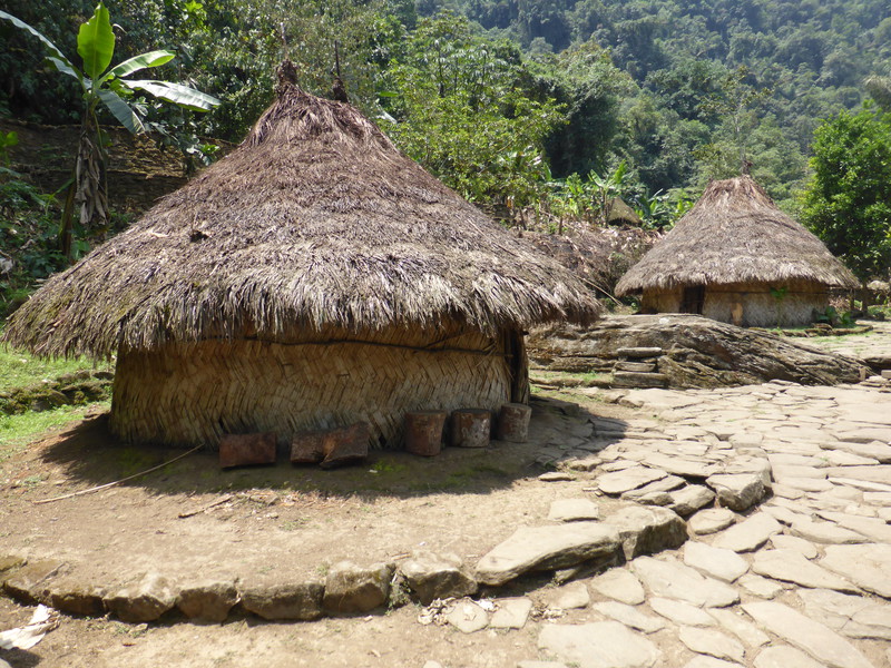
Thankfully, after all this effort, the Lost City turned out to be absolutely stunning. The city itself consists of some 169 terraces spread over about two square kilometres, built along the top of a north-south ridge, with the terraces getting higher and higher as you head south from the city entrance. These terraces are covered in low circular stone platforms, where wooden huts once stood. The site is split up into four different areas that are criss-crossed by a network of stone paths, and as you walk through the site from La Gallera through to Eje Central, and then down into Piedras and back through El Canal, the whole city slowly unfolds in front of you, with glimpses of higher terraces teasing you through the trees ahead.

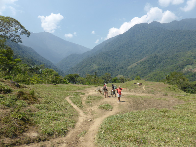
The money shot is when you reach the big grassy platform in Eje Central and the forest canopy suddenly disappears, leaving you with an utterly breathtaking view over heavily forested valleys on both sides of the ridge where the city sits; to the south of you the sequence of stepped terraces continues along the ridge and up the hill ahead of you, each of them home to more circular platforms. It's hard not to feel giddy as you stand there, with the hot breeze in your face and the whole world beneath your feet, as for the first time you get to see exactly how the city is laid out along the spine of the Sierra Nevada. I know it's a cliché, but photographs don't really do it justice; you really do have to be there to feel the power of the city as it stretches along the ridge like the proverbial stairway to heaven.

Of course, the view from the top of the hill is the most impressive, as you look back at the string of circular platforms. They appear to be suspended in the sky, like huge lily pads floating above the surrounding forest, and even with the ludicrous screeches of the large group of Americans who'd arrived there ahead of us, it wasn't hard to lose ourselves in the view. Sure, I had to wait while Rambo stopped posing on the summit so I could take some pictures without having to Photoshop him out later, and yes, there was a particularly annoying Chilean couple who spent ages taking photos of each other in stupid yoga poses, studiously ignoring the rest of us asking them if they would mind hiding for a moment so we could get at least one shot of the terraces without them in it. But after we popped into the ranger's hut for a cold beer while the American contingent ran riot outside, they eventually packed up and headed off, and the site quietened right down, leaving just the four of us to enjoy the serenity of the site for a few minutes of complete peace.

It was wonderful. With nothing breaking the silence except the distant cries of howler monkeys and musical bird song, we sat and lapped up the atmosphere. When we finally moved on from the main part of the city, I was the last to leave, but before I followed the others back into the jungle, I stopped and took a few seconds to take in my surroundings. For a short moment I had an entire Lost City all to myself – if you ignore the soldiers at the top of the hill – and I took a deep breath, looked up to the skies, stuck my arms out and did a little spin, just like Julie Andrews in the opening credits of The Sound of Music.

But it wasn't over, for Antonio then led us through the more overgrown districts of Piedras and El Canal, where he gave us a couple of coca leaves to suck on as we wandered through vine-strewn ruins that reminded me of the wonderful jungle ruins in Caracol in Belize. The coca leaves were all part of the experience, because the Kogi tribe still take coca as part of their traditional way of life, and they are still allowed to grow the plant, for personal use. They heat up the leaves with hot rocks to dry them out, and they then chew them with a powder made from ground-up seashells, as the alkali in the seashells reacts with the coca to produce the alkaloid that makes cocaine such a big seller. We stuck to plain old raw leaves, which are about as strong as coffee (and, to be honest, fairly imperceptible when you've just drunk an ice-cold beer on an empty stomach after hiking up 1200 stone steps in the tropical heat). Still, it was nice to be chewing the leaf as we explored the rest of the city, if only because it felt ever so slightly dangerous and exotic.

All things must pass, though, and after four hours of exploring the site, we started back down the steps to the river, and retraced the path back to the camp. It was at this point, with impeccable timing, that the battery on my camera, which I'd been carefully conserving, finally ran out, leaving me free to do the rest of the walk without worrying about taking pictures. As the return journey to Machete is along the same path and you end up staying in the same camps, this was no hardship; in fact, I loved the freedom of not being able to take photos, as sometimes having a camera can feel a bit like an obligation. I had my pictures of the walk already, and it felt good to have it in the bag.

After a quick swim at Alojamiento El Paraíso, we had another excellent lunch, consisting of a huge mound of sausages, eggs, rice and lentils. This time it proved too much for one of the Americans, who asked Antonio, 'That looks good, how do I get one of those?'
'You don't,' said Antonio. 'These are for my group only.'
'Oh man,' said the American, and sat down to the meal of comparatively uninspiring spaghetti that his group were having.

And with that we hit the trail, slowly retracing our steps back to Alojamiento Tezhúmake, some three hours away. We found it an enjoyable walk, despite being tired from our early start and the long exploration of the city, but not everyone we met was so happy. At one point we came across a young Australian man who was hobbling his way down to the crossing of the Buritaca, and it turned out he'd twisted his ankle on the way back from the Lost City. But instead of sticking it in the cold waters of the river, he kept on walking, grimacing in pain, and we bumped into him again five minutes down the trail, where he was literally screaming whenever he put his weight on it.
'Are you OK?' I asked as we walked past him.

'Yeah, I'm fine,' he said, despite clear evidence to the contrary; his ankle was hugely swollen and he looked like he was in all sorts of trouble.
'Would you like some painkillers?' I asked.
'No thanks, I'm not taking anything,' he replied. 'I'm OK.'
'Well, you're clearly not OK,' I thought, but he obviously wasn't into taking advice from a couple of old people, so we left him to it. Later in the day, he was led past on a mule by a Kogi man and a couple of Kogi kids; he was far too big for the poor animal, but if you injure yourself out here, that's the only way out, as there are no roads, just the Kogi and their mules. We would meet him a few more times on the way out; I'm sure he was thrilled by the prospect.

We also passed the stragglers from the American group, who'd left the last camp half an hour before us. They looked pretty beaten; the girl who'd been having the breakdown the night before was sobbing quietly as she slowly shuffled one foot in front of the other. In contrast, her boyfriend overcompensated with a very cheery response to our smiling hellos, and who can blame him? We were surely witnessing either the end of that relationship, or a redefinition of it; that's how bad things can get when you bite off more than you can chew.

Meanwhile another American, this time a middle-aged guy with a paunch and a very red face, sat down heavily at the shop on the top of the hill and loudly sighed, 'I ache everywhere: my feet, my legs, my back, absolutely everywhere. This is hell.' Even our group wasn't immune; as we downed a bottle of Coke at the shop and caught our breath, Oliver revealed that he'd tripped over near the start of the walk and landed awkwardly on his knee, so Emily was having to carry their shared backpack and progress was painfully slower than normal. She was also suffering, as she'd had a nasty headache that morning at the Lost City, probably from dehydration, and she still wasn't feeling that good.
It seemed that people were dropping like flies around us as we took our time on the long descent back to Alojamiento Tezhúmake. I idly wondered when it would be our turn, with just one more day to go.
Day 5: Alojamiento Tezhúmake to Machete (15.7km)

The hardest part of the entire trek turned out to be the final day, which combined the first two days of the walk into one long day, but walked in the opposite direction. On paper this didn't sound too bad, as overall the walk would be downhill, but every hill you climb on the way in becomes a descent on the way out, and every descent becomes a climb, so our final day had two huge climbs and two long descents. This would have been a difficult walk on its own – even though, by this point, we were much fitter than when we'd started and had the added advantage of knowing what to expect – but just to make it a real challenge, the sun came out and started baking us as soon as we emerged from the forest, even though we'd set off before 7am and it was still early, so it was clearly going to be a hot day.

It was particularly bad on the second half of the walk, when we did day one in reverse. The multicoloured chalk gashes that we'd rolled down at the end of the first day turned into a superheated slog up 150m of oven-hot ascent. It was absolutely brutal – that was the one word that everyone we spoke to used, even the hardcore walkers we met – with temperatures in the shade of 45°C and baking hot sun reflecting off the chalk walls. Even Antonio thought it was too hot; he had a thermometer in his pack, and when he fished it out and saw the temperature, he whistled and said, 'Mucho calor,' which was putting it mildly. We staggered on, stopping in every shady patch, and eventually we reached the top of the final descent that would take us back down to the river and to Machete.
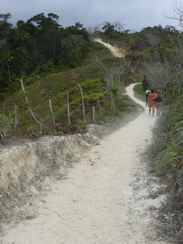
That descent felt endless. The fine dust that had coated us on the way up made for treacherous conditions underfoot, and even with our sticks, something was bound to happen, and it did. Halfway down the steep hillside, Peta stumbled on a rock and fell heavily onto her knees and wrists, twisting her ankle under herself as she fell.
As the dust settled, we did a sanity check. Did anything hurt? How was her ankle? What about her wrists? Slowly she stood up, gently testing the ankle, and thankfully it wasn't badly sprained. She had a small cut on one knee and a graze on the other, so I washed them off with the remains of our water while she checked herself for serious injuries. Amazingly, there were none; her ankle was a little sore but basically all right, her cuts weren't deep, and her wrists were fine apart from some bruising on the left one where she'd taken the weight of her body. It was a very lucky escape.

So we took it even more slowly than before on the way down, and when we finally reached the swimming hole where we'd stopped on day one, we threw off our stinking T-shirts and jumped in, safe in the knowledge that the trailhead was only 20 minutes away along a gentle river valley. And we looked at the group who were packing up after their first swim in the waterhole, getting ready to tackle the trail, and remembered how we'd felt on that first day, totally unaware of what was in store. This group had big backpacks and huge camera bags... and they were about to head out into the full sun, which we'd managed to miss on our first day.
'Good luck,' I thought. 'You'll need it.' And with that we finished off the last part of the walk, downed a celebratory cold beer in Machete over lunch, thanked Antonio with a well-deserved tip, and headed back to Santa Marta to stick everything we'd carried into the wash, including ourselves.
If you're thinking of doing the trek to the Lost City yourself, then I've put together some walking tips that you might find useful.